Under SVAMITVA, the inhabited area of your village is mapped from the air, checked on the ground and turned into a legal record of who owns which house and plot. The Survey of India handles the drones and maps. The State Revenue Department, with the Panchayati Raj Department and the Gram Panchayat, handles notices, verification and the property cards.
The steps follow the Ministry of Panchayati Raj’s scheme guidelines. States can adjust details under their own revenue laws, so always follow the notice issued for your village.
The process at a glance
| Step | Who does it | What you do |
|---|---|---|
| 1. Notification | Collector | Read the notice |
| 2. Gram Sabha | Panchayati Raj Dept | Attend; ask questions |
| 3. Chuna marking | Revenue + GP | Show your boundary |
| 4. Drone flight | Survey of India | Nothing; stay safe |
| 5. Ground truthing | SoI + Revenue | Be present; check map |
| 6. Objections | Enquiry officer | Object in time |
| 7. Final record | State Revenue | Collect your card |
SoI is the Survey of India and GP is the Gram Panchayat.
Source: SVAMITVA guidelines, sections 3.2 and 5.1 (Ministry of Panchayati Raj).
Before the survey: the CORS network
Before any drone flies, the Survey of India sets up a network of Continuously Operating Reference Stations (CORS) across the state. These fixed stations constantly receive satellite positioning signals and send corrections, so survey equipment can fix a location to within a few centimetres in real time. The Ministry describes the CORS network as public infrastructure that gives positioning accuracy of about 5 cm.
For the survey, CORS helps set up ground control points: marked spots with known coordinates that tie the drone photographs to the real ground. It also helps later with ground truthing and demarcation.
Step 1: Notification of the survey area
The regional revenue office takes permission from the Collector’s office, and the Collector notifies the survey area through a public notice. The guidelines also mention notices to people holding land next to the abadi, so that the outer boundary of the inhabited area is fixed fairly.
What you do: read the notice on the Panchayat notice board or in local announcements, and note the survey dates.
Step 2: Gram Sabha and awareness
The State Panchayati Raj Department invites residents to a Gram Sabha. There, officials explain the survey schedule, the method and why it matters. States also run awareness work: posters, public announcements, information walls, short films and, in some places, puppet shows or mobile vans.
What you do: attend the Gram Sabha if you can. Ask when lime marking will happen in your lane, what proof of ownership the enquiry will look at, and whether anyone in your household needs to be present on particular days.
Step 3: Chuna marking of property boundaries
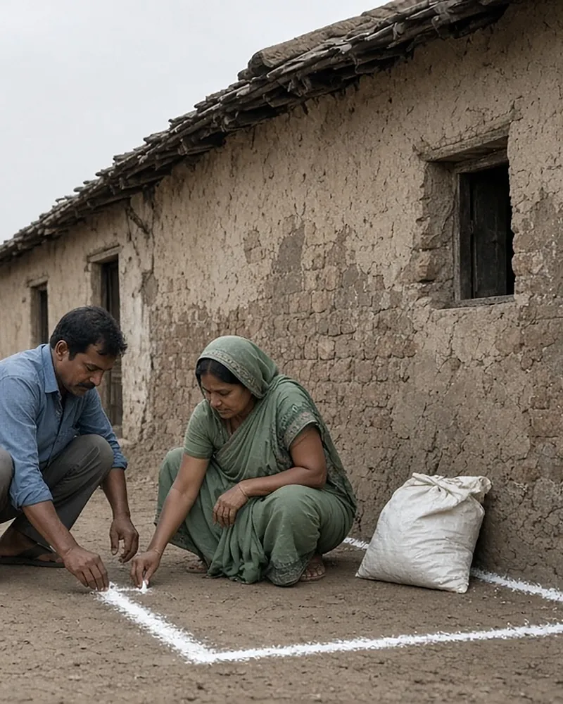
The State identifies every individual property, government asset, Gram Sabha land parcel, road and open plot to be surveyed. Property boundaries are then marked on the ground with white limestone powder, known as chuna, or another suitable method. This is done jointly by Revenue Department officers and village residents, so the lines show up clearly in the drone photographs.
The no-chuna alternative. The guidelines allow a State and the Survey of India to agree on another approach. In that case, the drone flies without prior lime marking. All visible features, such as roads, houses, wells, streetlights and water bodies, are digitised from the images. The State then checks the map on the ground and adds any missing parcel boundaries. The corrected version, called “map 2”, is used for the next steps.
What you do: be at home, or have a family member there, when your plot is being marked. Point out your full boundary, including any shared walls or open land you own. If a neighbour disagrees about a line, say so then. The Gram Panchayat and Revenue staff can note it, and you can raise it formally at the objection stage.
Step 4: Drone flight
The Survey of India gets permission to fly from the Directorate General of Civil Aviation and the Ministry of Defence, and it plans the flight using existing maps or satellite images. It places ground control points or check points before flying.
The drones are professional survey-grade aircraft with positioning systems known as RTK or PPK. They carry high-resolution cameras that capture images sharper than 5 cm per pixel. The flight covers the abadi, inhabited areas next to it, and wadis or basties.
What you do: nothing special. Keep children and animals clear of the take-off area, and do not try to fly your own drone nearby.
Step 5: Map processing and ground truthing
The Survey of India processes the photographs in its GIS lab into elevation models and ortho-rectified images (photographs corrected so that distances are true). From these, it extracts features and draws land parcel maps at 1:500 scale. Properties are numbered using the State’s numbering system. A GIS database links each parcel to its details. The processed maps are then checked on the ground for accuracy better than 10 cm.
Ground truthing means the Survey of India and the State Revenue Department take the draft map back to the village and check it against what is really there. Missing walls, merged plots, wrong numbering and similar errors are corrected.
What you do: if officials visit with a printed or tablet map, check that your plot’s shape and size match what you hold, and that your name and your co-owners’ names are spelled correctly.
Step 6: Enquiry, objections and dispute resolution
The State issues a legal notification for joint verification of ownership by the Revenue Department and the Gram Panchayat. An inquiry follows. Survey officials verify who owns each parcel with the help of the Gram Sabha and the owners, and they examine whatever documents exist.
The State then publishes the draft results for claims and objections, as its revenue law requires. Objections may be about the owner’s name, the boundaries or joint holding. An enquiry officer re-verifies the facts and decides. If an objection is still unresolved, the final decision rests with the District Magistrate or Collector, or with another mechanism the State sets.
In a Lok Sabha reply of 11 August 2026, the Ministry said that where competent authorities find genuine technical issues or survey deficiencies, corrective steps are taken, including re-flying the drones.
What you do: check the published draft for your plot. If anything is wrong, file an objection within the period in the notice. That period was between 7 and 90 days in the states listed in the Ministry’s 2022 Expert Committee report. See objections and disputes for state periods and how to file.
Step 7: Final record and property cards
After ground truthing, the inquiry and dispute resolution, the final digital maps, land parcel maps and GIS data are produced. The State prepares the record of rights for the abadi, and property cards are printed and given to owners as the legal document of ownership. The Gram Panchayat updates its property tax and asset register where that applies, and the State Revenue Department keeps the maps up to date after that.
What you do: collect your card at the distribution event or from the tehsil or Gram Panchayat. Check it at once, and keep it safe with a copy. See how to get and download your card.
Checklist for villagers
| Stage | Your checklist |
|---|---|
| Notice | Note the dates |
| Gram Sabha | Ask about your lane |
| Marking | Be present; show limits |
| Flight | Keep the area clear |
| Ground check | Check shape and names |
| Draft record | Object within the period |
| Card | Collect, check, copy |
Accuracy and scale of the maps
| Item | Standard |
|---|---|
| Map scale | 1:500 |
| Image resolution | Better than 5 cm |
| Ground check | Better than 10 cm |
| Positioning | CORS, about 5 cm |
These are the standards in the guidelines and the Ministry’s March 2025 release. They are why the maps can show individual walls and narrow lanes, and why they are useful for settling boundary disputes. The finished maps also feed the Ministry’s village planning tool. See Gram Manchitra and related systems.
Frequently asked questions
What is chuna marking in SVAMITVA?
It is the marking of property boundaries on the ground with white limestone powder before the drone flight, done jointly by Revenue officers and residents so the boundaries show in the images. Some states use an agreed method without lime marking and add the boundaries during ground checks.
Do I need to be present during the drone survey?
You do not need to be present for the flight. Try to be present, or send a family member, when your boundary is marked and when officials do the ground check, so your plot and your name are recorded correctly.
What is ground truthing?
Ground truthing is checking the draft drone map against the actual ground. The Survey of India and the State Revenue Department do it together and correct the map before the ownership enquiry and objections.
How long does the SVAMITVA survey take?
The guidelines do not set a fixed time for each village. The objection period alone ranges from 7 to 90 days in the states listed by the Ministry’s Expert Committee, and printing and distribution follow after that. Ask your Gram Panchayat or tehsil for your village’s schedule.
Can the drone survey be done again if the map is wrong?
Yes, where the State’s competent authority finds a genuine technical problem or survey deficiency. The Ministry told the Lok Sabha in August 2026 that corrective measures include re-flying drones as required.
Who pays for the survey?
The Ministry of Panchayati Raj funds the Survey of India for the drone survey and maps. The guidelines do not ask owners to pay anything for the survey.
Read more on what SVAMITVA is or the SVAMITVA FAQ.